
Stormchasen in Nederland, met een schuin oog naar Amerika!
Moderators: NadjaNadja, Essie73, Muiz, Polly, Telpeva, ynskek
- jokari
-

- Berichten: 9155
- Geregistreerd: 06-06-04
- Woonplaats: thuis
Re: Stormchasen in Nederland, met een schuin oog naar Amerika!
![]() Geplaatst: 11-07-15 17:18
Geplaatst: 11-07-15 17:18
- Animal
-

- Berichten: 8464
- Geregistreerd: 03-03-12
- Woonplaats: Westerlee
Re: Stormchasen in Nederland, met een schuin oog naar Amerika!
![]() Geplaatst: 11-07-15 17:21
Geplaatst: 11-07-15 17:21
 Zijn ook erg mooie foto's!
 - Anoniem
Re: Stormchasen in Nederland, met een schuin oog naar Amerika!
![]() Geplaatst: 11-07-15 17:44
Geplaatst: 11-07-15 17:44

- k_m
-

- Berichten: 5332
- Geregistreerd: 03-02-10
Re: Stormchasen in Nederland, met een schuin oog naar Amerika!
![]() Geplaatst: 11-07-15 18:39
Geplaatst: 11-07-15 18:39
Mijn broer trouwt dan en we hebben een tuinfeest, dus zijn benieuwd. En zou handig zijn voor de voorbereidingen!
- Annash
- Blogger
-

- Berichten: 26891
- Geregistreerd: 09-06-03
- Woonplaats: Achterhoek
Re: Stormchasen in Nederland, met een schuin oog naar Amerika!
![]() Geplaatst: 11-07-15 22:01
Geplaatst: 11-07-15 22:01
- k_m
-
- Berichten: 5332
- Geregistreerd: 03-02-10
Re: Stormchasen in Nederland, met een schuin oog naar Amerika!
![]() Geplaatst: 12-07-15 10:08
Geplaatst: 12-07-15 10:08
- MonteKarlo
-

- Berichten: 2202
- Geregistreerd: 28-07-10
- Woonplaats: Brabant
![]() Geplaatst: 12-07-15 11:37
Geplaatst: 12-07-15 11:37
k_m schreef:Oké maar een algemeen beeld of er dan net een zone met goed weer of bar slecht weer komt, dat is toch te doen lijkt me?
Daarvoor kun je kijken op weeronline of iets dergelijks en dan de 14 dagen vooruit verwachting bekijken, maar als je die vandaag bekijkt en dan overmorgen weer, is dat beeld waarschijnlijk ook alweer veranderd

- k_m
-
- Berichten: 5332
- Geregistreerd: 03-02-10
Re: Stormchasen in Nederland, met een schuin oog naar Amerika!
![]() Geplaatst: 12-07-15 17:26
Geplaatst: 12-07-15 17:26
- _l_amanda_l_
-

- Berichten: 6066
- Geregistreerd: 31-01-08
- Woonplaats: op de grens van Friesland en Drenthe
Re: Stormchasen in Nederland, met een schuin oog naar Amerika!
![]() Geplaatst: 12-07-15 21:08
Geplaatst: 12-07-15 21:08

- marygoround
-

- Berichten: 834
- Geregistreerd: 24-04-11
- Joyce_R
-

- Berichten: 735
- Geregistreerd: 06-08-12
- Woonplaats: 'S-Hertogenbosch
![]() Geplaatst: 13-07-15 09:20
Geplaatst: 13-07-15 09:20
marygoround schreef:Zijn er hier nog mensen die de stream bekijken? Ik vroeg me random af of er wat te zien was en werd me toch even getrakteerd op een partij mooie beelden
Alleen jammer dat ik eigenlijk vroeg naar bed wilde vanavond en me nu meteen weer laat verleiden langer door te kijken
Ik was gisteravond ook eventjes aan het kijken. Maar de stream liep telkens een beetje vast, dus was maar gaan slapen. Bij nader inzien een minder goed plan, gezien de beelden die voorbij kwamen die ik nu op Facebook zie

- Maureen95
-

- Berichten: 16648
- Geregistreerd: 26-10-11
Re: Stormchasen in Nederland, met een schuin oog naar Amerika!
![]() Geplaatst: 13-07-15 23:22
Geplaatst: 13-07-15 23:22
- Anoniem
Re: Stormchasen in Nederland, met een schuin oog naar Amerika!
![]() Geplaatst: 14-07-15 10:24
Geplaatst: 14-07-15 10:24
Nieuwe onweerskansen voor komende donderdagavond/nacht. Waarschijnlijk zal een buienlijntje van zuid west naar noord oost trekken. Misschien ga ik nog wel even op pad
- Diva_Jenny
-

- Berichten: 872
- Geregistreerd: 23-12-05
- Woonplaats: TT city

- Mer1980
-

- Berichten: 21406
- Geregistreerd: 08-02-01
- Woonplaats: Lelystad
Re: Stormchasen in Nederland, met een schuin oog naar Amerika!
![]() Geplaatst: 14-07-15 17:23
Geplaatst: 14-07-15 17:23
- MonteKarlo
-
- Berichten: 2202
- Geregistreerd: 28-07-10
- Woonplaats: Brabant
![]() Geplaatst: 14-07-15 21:22
Geplaatst: 14-07-15 21:22
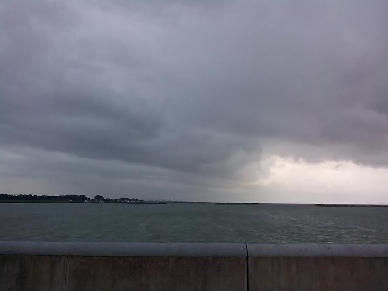
Diva_Jenny schreef:Waterhoos op het wad gister bij Harlingen. Foto is gemaakt door mijn moeder. Ik heb de waterhoos zelf jammer genoeg niet gezien. Vind dit soort weerfenomenen altijd erg interessant, en volg dit topic dan ook graag!
[ Afbeelding ]
Gaaf !

- Anoniem
Re: Stormchasen in Nederland, met een schuin oog naar Amerika!
![]() Geplaatst: 14-07-15 21:24
Geplaatst: 14-07-15 21:24
Kaartje voor donderdagnacht zal ik nog ff opzoeken, weer kans op supercellen


- Anoniem
![]() Geplaatst: 16-07-15 06:02
Geplaatst: 16-07-15 06:02
en level 1 voor de rest Dit worden waarschijnlijk buien die vanuit Frankrijk deze kant op komen. Er wordt trouwens een 'rightmover' voorspelt. Deze zal van de westkust van Frankrijk schuin over NL trekken. Kunnen leuke dingen in zitten dan
Misschien toch maar even op pad vanavond 

Citaat:Storm Forecast
Valid: Thu 16 Jul 2015 06:00 to Fri 17 Jul 2015 06:00 UTC
Issued: Wed 15 Jul 2015 22:04
Forecaster: GATZEN
A level 2 was issued for parts of NW Germany, Benelux, N France, and S UK mainly for large hail, severe wind gusts, and to a lesser extend tornadoes and excessive precipitation.
A level 1 was issued for central and southern France, and NE Spain mainly for large hail and severe wind gusts.
SYNOPSIS
At the southern flank of low geopotential across Scandinavia and between Iceland and the British Isles, a rather zonal flow has advected moist air into Europe. Soundings from northern France/southern UK to western Germany indicate rich and deep moisture with surface dewpoints around 16°C. South of this frontal zone, a ridge is present, and steep lapse rates have spread from northern Africa into SW Europe.
On Thursday, the north-west European trough will move southward. Together with another low W of Iberia, it yields a south-westerly flow across western Europe. Advection of warm and well-mixed air masses is expected until the end of the period, when the axis of warm air will reach from central France to south-western Germany. Ahead of a cold front across the eastern UK and western France, a strong low-level jet will spread into the Benelux countries and NW Germany at the end of the period.
DISCUSSION
Southern/eastern UK into northern France, Benelux, and NW Germany
The warm air advection regime will see quickly improving lapse rates atop of a moist boundary layer from W Germany across Benelux into northern France and the southern UK. Given the rich low-level moisture, model CAPE values of 1000 J/kg MLCAPE seem to be reasonable during the afternoon and evening. Initiation becomes likely in the evening hours due to the approaching cold front and frontogenetical forcing. QG forcing will increase across the UK due to DCVA.
Storms are forecast to form across northern France in the late afternoon, spreading eastward into the Benelux in the evening. Additional storms may develop across southern and eastern UK. Due to the strong low-level jet, 15 m/s low-level vertical wind shear will be available, and storms can quickly become supercells, capable of producing large hail, severe wind gusts, and flash flood. Tornadoes are also forecast with the highest threat in the evening hours from Belgium into the SE UK. Strong tornadoes are not ruled out given the strong low-level jet and associated vertical wind shear.
In the evening and night hours, storms are forecast to cluster, spreading north-east. Severe threat will gradually weaken as storms become elevated, but given the strong low-level jet and ongoing frontogenetical forcing, threat of large hail, severe winds, tornadoes, and excessive rain is expected to continue until the early morning when the main activity is expected to shift to western Germany.
Laatst bijgewerkt door Anoniem op 16-07-15 06:03, in het totaal 1 keer bewerkt
- janouk
-

- Berichten: 18928
- Geregistreerd: 18-04-06
- Anoniem
![]() Geplaatst: 16-07-15 06:04
Geplaatst: 16-07-15 06:04
janouk schreef:@joolien
mijn zoon zit in Japan nu, midden in de typhoon, categorie 3.
en de mamma zit thuis in de zenuwen.
en ik moest aan jou denken. Jij zou h
je midden in het oog van de typhoon prima vermaken.
pppfff wat zou ik hem nu graag thuis hebben
Oh wat vervelend zeg. Maar ik denk dat ik dat ook niet zo leuk zou vinden hoor. Ja eventjes, maar zodra het dodelijk wordt, loop ik iets minder hard van stapel